Fairfax Fire & Rescue Station Location Optimization Web Map Application
November 2020
GIS|Analysis|Design
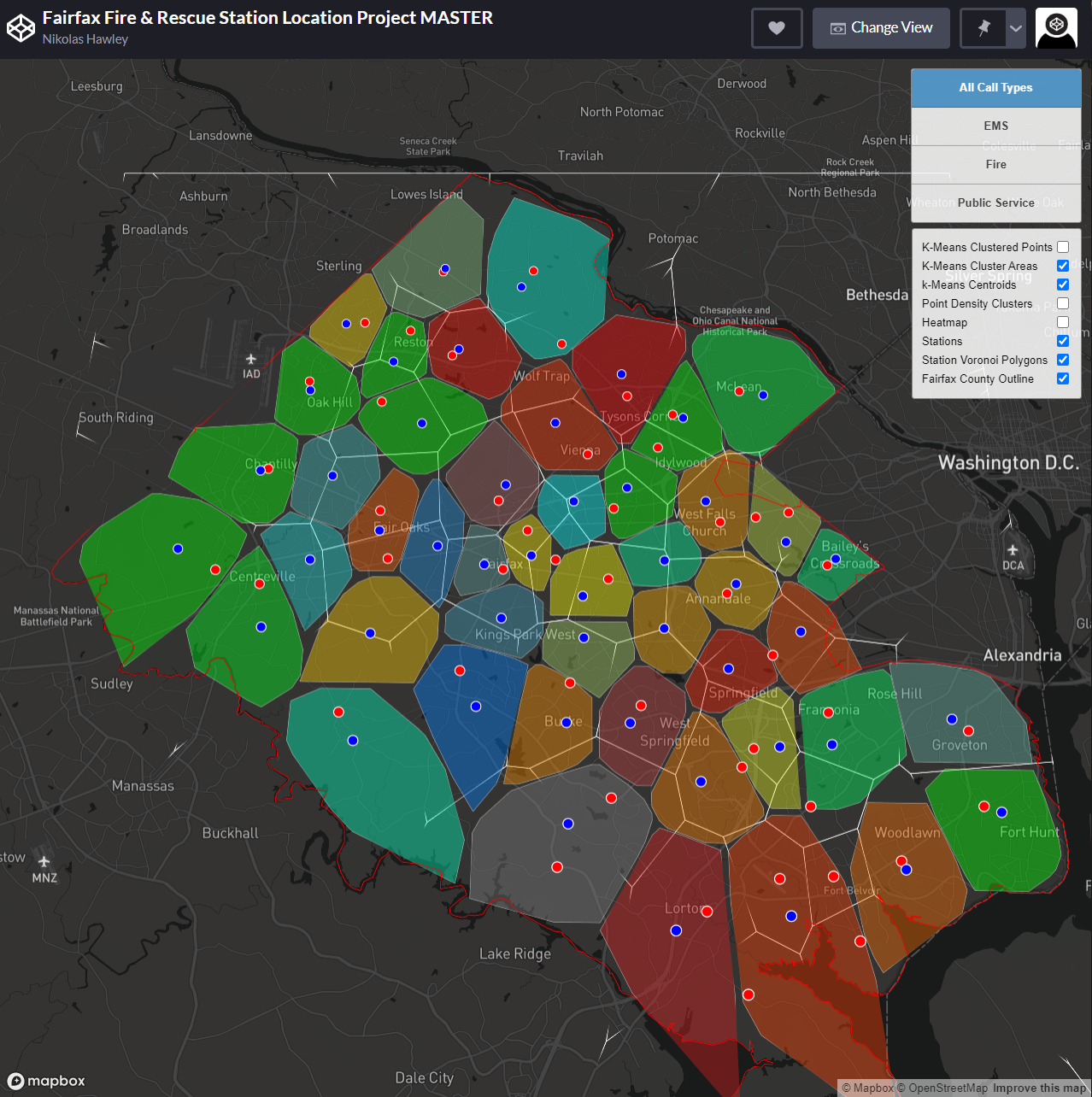
This dynamic web map product was completed as a final project for my upper level Web Mapping course at George Mason University. The goal of the team project was to create a web mapping application using open source Javascript libraries. My team's application focused on investigating the optimization of Fire & Rescue stations within Fairfax County, VA based on comparing current station locations with the centroids of EMS call clusters.