ASCE UESI Surveying Competition - Topographic Mapping
March 2022, May 2022
Engineering|Surveying|Analysis
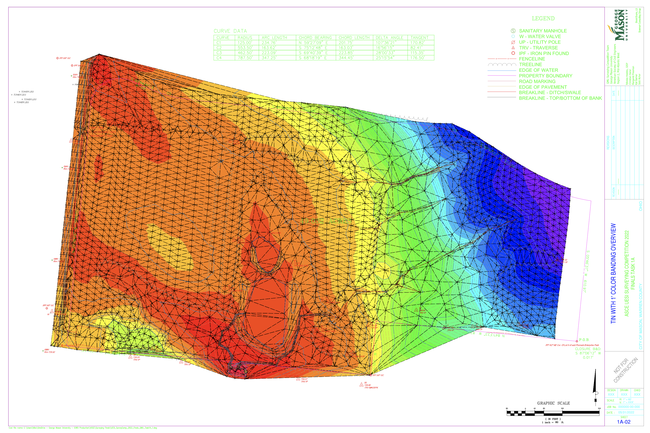
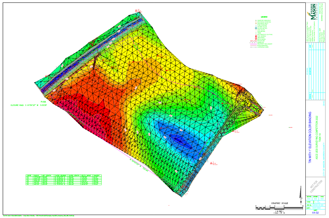
These topographic map products were created for Task 1A of the American Society of Civil Engineers (ASCE) Uitilities Engineering & Surveying Institute's (UESI) 2022 student Surveying Competition. This task involved processing a given PNEZD point file of survey data in Autodesk Civil 3D to create a topographic map, Triangulated Irregular Network (TIN) surface, and 1' color banding. The first product was completed for Regional level Competition and the second for Society-wide finals, where our team representing George Mason University placed 2nd in the Field Survey Engineering tasks and 3rd Overall.
What I did
- Survey Data Processing
- Surface Creation
- Topographic Mapping
- Layout Preparation
Tools I used
- Civil 3D