Virginia Bridge Analysis
December 2020
GIS|Cartographic|Analysis
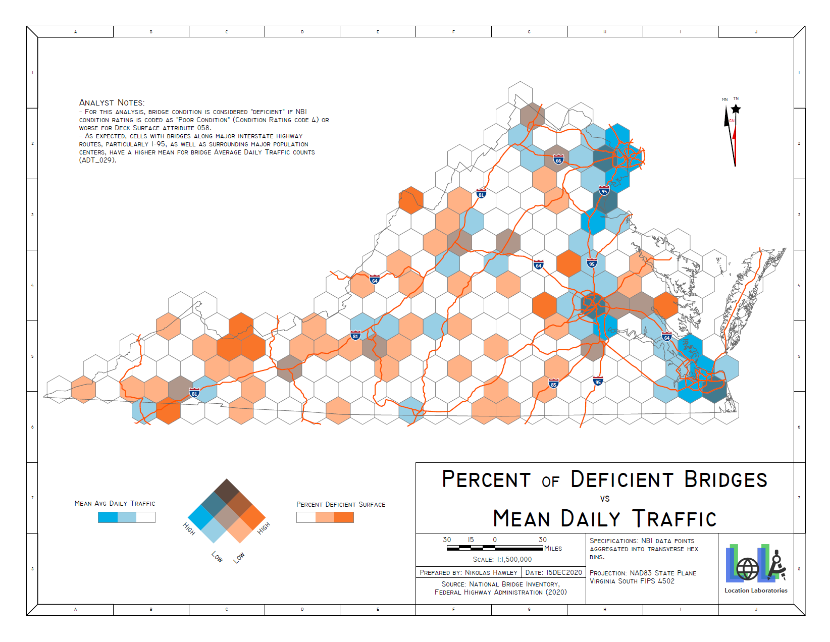
This static bivariate map product was completed as my final project for my Intro Cartography course at George Mason University. Bridge data points from the Federal Highway Administration's (FHA) National Bridge Inventory (NBI) within Virginia were aggregated and analyzed to explore potential relationships between Average Daily Traffic (ADT) and surface condition for bridges within arbitrary transverse hexagon bins.