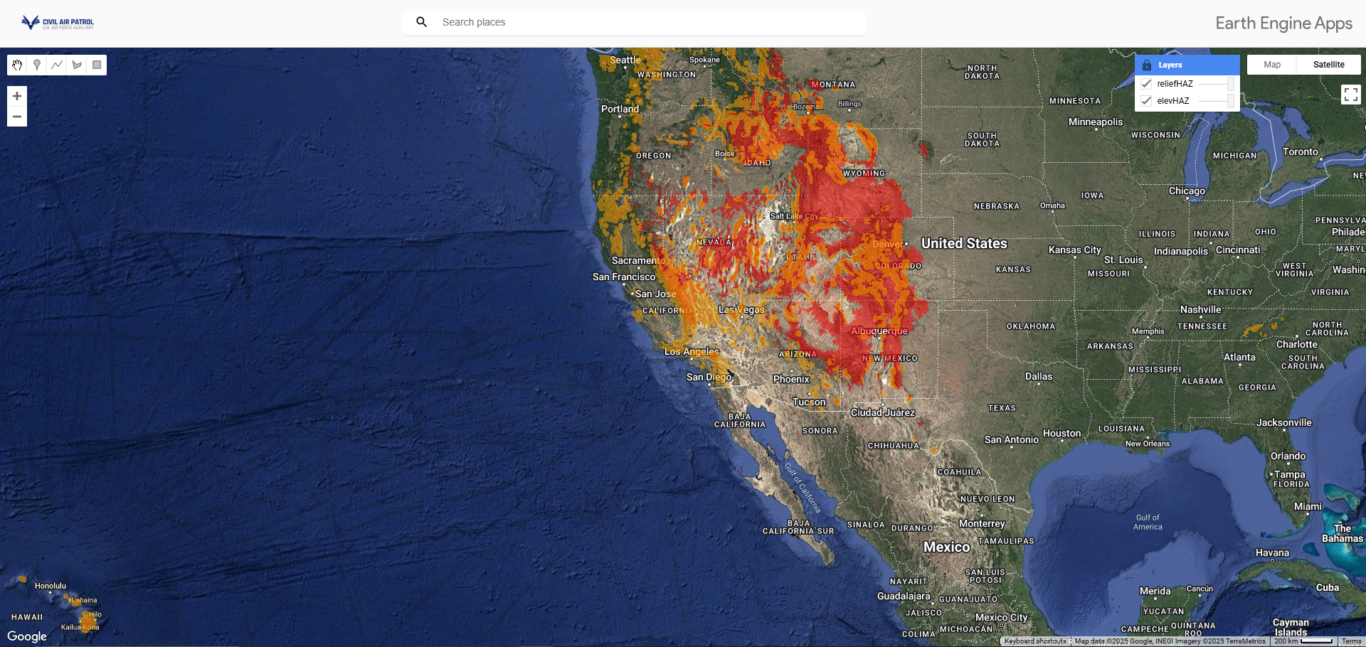
Civil Air Patrol Designated Mountain Areas
February 2025
GIS|Analysis|Engineering|Code
This Google Earth Engine (GEE) webmap app product was created in order to understand and visually refine aviation standards regarding Mountainous Terrain for Civil Air Patrol (CAP) Aviators; The GEE code behind the app analyzes ground elevation on the fly to identify places where ground elevation changes by 3,000’ or more within 10 NM. This terrain lies within generalized Designated Mountainous Area (DMA) (Aeronautical Information Manual, Section 5-6-15; 14 CFR 95.11.; CAP Standard 71-1).