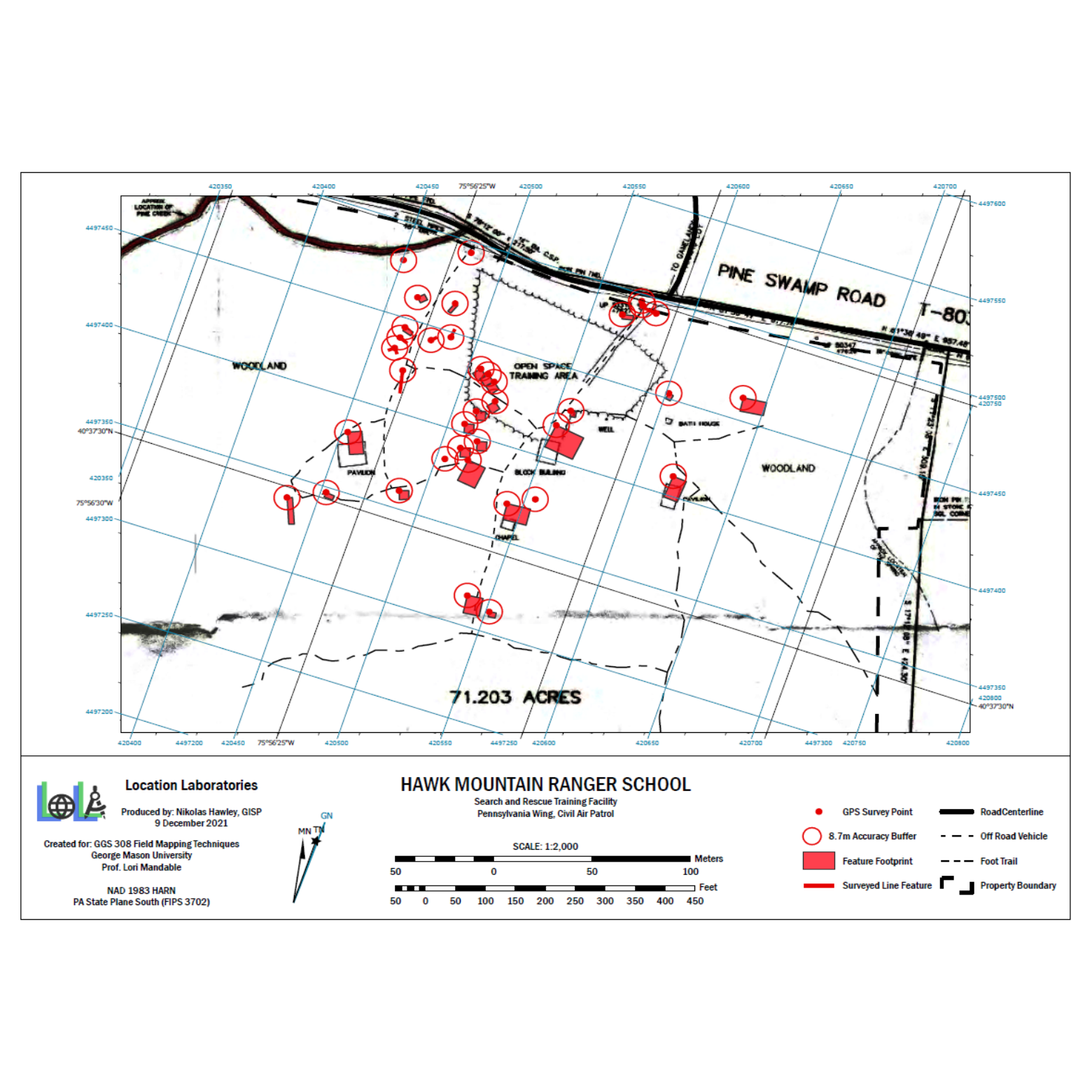
Hawk Mountain Ranger School Field Mapping
December 2021
Engineering|Surveying|GIS|Analysis
This field mapping project developed during my time in George Mason University GGS 308 Field Mapping course. The project involved the use of applied field mapping methods to collect, evaluate, process, analyze and map geospatial field data. My project specifically updated outdated facility maps for Civil Air Patrol Hawk Mountain Ranger School Search & Rescue Training Facility.